VR3D Présente son matériel
VR3D • 10 novembre 2021
VR3D vous présente son Faro Focus S150

Aujourd'hui le FARO S150
Scanner terrestre de haute précision, utile pour effectuer un contrôle de planéité de dalle, un suivi d'auscultation d'ouvrage ou la prise en compte bâtiments complexes.
Nous serons dès lors en mesure d'analyser et traiter les données suivant vos besoins.
#FAROs150 #LASERGRAMMETRIE #POINTCLOUD #IFC #BIM #DIGITALTWIN #3DVISUALISATION
The body content of your post goes here. To edit this text, click on it and delete this default text and start typing your own or paste your own from a different source.

The body content of your post goes here. To edit this text, click on it and delete this default text and start typing your own or paste your own from a different source.

The body content of your post goes here. To edit this text, click on it and delete this default text and start typing your own or paste your own from a different source.

The body content of your post goes here. To edit this text, click on it and delete this default text and start typing your own or paste your own from a different source.

The body content of your post goes here. To edit this text, click on it and delete this default text and start typing your own or paste your own from a different source.

The body content of your post goes here. To edit this text, click on it and delete this default text and start typing your own or paste your own from a different source.

The body content of your post goes here. To edit this text, click on it and delete this default text and start typing your own or paste your own from a different source.

The body content of your post goes here. To edit this text, click on it and delete this default text and start typing your own or paste your own from a different source.

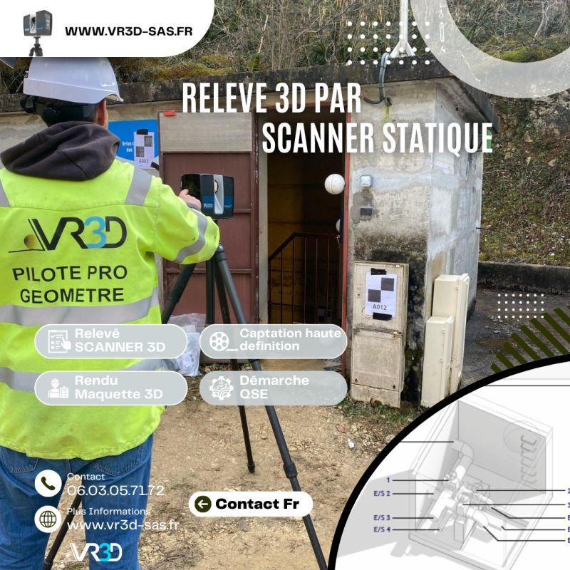
🌧️ Maîtriser et gérer les ouvrages EP commence par obtenir une donnée fiable. Chez VR3D, nous avons récemment réalisé un relevé 3D haute précision de buses d’eaux pluviales afin de sécuriser leurs ouvrages. 🎯 Problème : géométrie complexe, accès contraint, besoin d’une précision centimétrique. 💡 Solution : scan 3D haute densité + Nuage de points géoréférencé + modélisation exploitable immédiatement par les équipes MOE. 📊 Résultat : gain de temps, fiabilité des métrés, anticipation des risques hydrauliques. 👉 Vous avez un ouvrage hydraulique à modéliser ? Échangeons ensemble www.vr3d-sas.fr hashtag#VR3D hashtag#Scan3D hashtag#Relevé3D hashtag#Géomètre hashtag#Hydraulique hashtag#Innovation hashtag#NuageDePoints

#GénieCivil #OuvrageDart #Topographie #InspectionTechnique #DroneProfessionnel